Active Wildfire Map: Real-time Tracking of US Wildfires
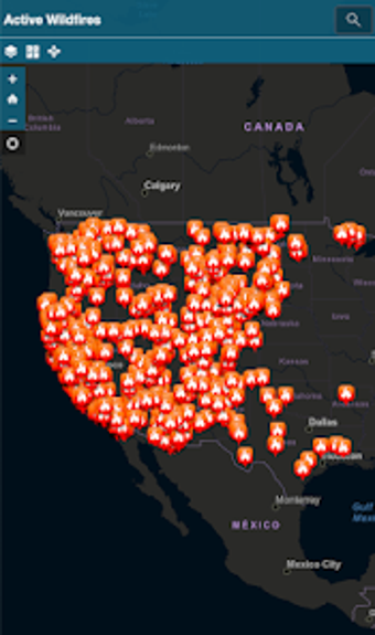
Active Wildfire Map is a free Android app developed by Severe WX Warn that provides real-time tracking of wildfires in the US. The app offers an interactive mapping interface that displays the current location, size, and containment status of active wildfires. The data is updated hourly, ensuring that users have access to the latest information on wildfires across the country.
One of the app's standout features is its GPS capabilities, which allow users to track wildfires in their immediate vicinity. This is particularly useful for those living in areas prone to wildfires, as it provides timely information that can help them take necessary precautions. The app also offers a detailed legend that explains the different symbols used on the map, making it easy to understand the information presented.